


Southwest Nebraska PUMA, Nebraska
About
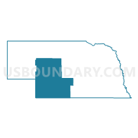
Outline

Summary
| Unique Area Identifier | 193329 |
| Name | Southwest Nebraska PUMA |
| State | Nebraska |
| Area (square miles) | 16,088.44 |
| Land Area (square miles) | 15,983.63 |
| Water Area (square miles) | 104.80 |
| % of Land Area | 99.35 |
| % of Water Area | 0.65 |
| Latitude of the Internal Point | 41.00423480 |
| Longtitude of the Internal Point | -100.95280210 |
Maps

Graphs
Select a template below for downloading or customizing gragh for Southwest Nebraska PUMA, Nebraska


Neighbors
Neighoring Public Use Microdata Area (by Name) Neighboring Public Use Microdata Area on the Map
- Central Nebraska PUMA, NE
- North Central & Northwest Nebraska PUMA, NE
- Northeast Colorado--Eastern Plains Region PUMA, CO
- Northwest Kansas PUMA, KS
- South Central Nebraska PUMA, NE
Top 10 Neighboring County (by Population) Neighboring County on the Map
- Buffalo County, NE (46,102)
- Lincoln County, NE (36,288)
- Dawson County, NE (24,326)
- Red Willow County, NE (11,055)
- Custer County, NE (10,939)
- Yuma County, CO (10,043)
- Phelps County, NE (9,188)
- Keith County, NE (8,368)
- Cherry County, NE (5,713)
- Norton County, KS (5,671)
Top 10 Neighboring County Subdivision (by Population) Neighboring County Subdivision on the Map
- North Platte precinct, Lincoln County, NE (24,733)
- Lexington city, Dawson County, NE (10,230)
- McCook city, Red Willow County, NE (7,698)
- Ogallala city, Keith County, NE (4,737)
- Wray CCD, Yuma County, CO (4,088)
- Cozad city, Dawson County, NE (3,977)
- Gothenburg city, Dawson County, NE (3,574)
- Holyoke CCD, Phillips County, CO (3,011)
- Osgood precinct, Lincoln County, NE (1,950)
- Wano township, Cheyenne County, KS (1,839)
Top 10 Neighboring Place (by Population) Neighboring Place on the Map
- North Platte city, NE (24,733)
- Lexington city, NE (10,230)
- McCook city, NE (7,698)
- Ogallala city, NE (4,737)
- Cozad city, NE (3,977)
- Gothenburg city, NE (3,574)
- Imperial city, NE (2,071)
- Sutherland village, NE (1,286)
- Grant city, NE (1,165)
- Cambridge city, NE (1,063)
Top 10 Neighboring Unified School District (by Population) Neighboring Unified School District on the Map
- North Platte Public Schools, NE (28,794)
- Lexington Public Schools, NE (12,327)
- McCook Public Schools, NE (9,174)
- Holdrege Public Schools, NE (6,994)
- Ogallala Public Schools, NE (6,735)
- Cozad City Schools, NE (5,227)
- Broken Bow Public Schools, NE (4,934)
- Gothenburg Public Schools, NE (4,528)
- Valentine Community Schools, NE (4,515)
- Norton Community Schools Unified School District 211, KS (4,473)
Top 10 Neighboring State Legislative District Lower Chamber (by Population) Neighboring State Legislative District Lower Chamber on the Map
- State House District 65, CO (77,293)
- State House District 63, CO (69,709)
- State House District 120, KS (19,519)
Top 10 Neighboring State Legislative District Upper Chamber (by Population) Neighboring State Legislative District Upper Chamber on the Map
- State Senate District 1, CO (125,154)
- State Senate District 40, KS (61,332)
- State Senate District 36, NE (37,224)
- State Senate District 42, NE (36,288)
- State Senate District 44, NE (33,011)
- State Senate District 38, NE (32,734)
- State Senate District 47, NE (32,377)
- State Senate District 49, NE (31,705)
- State Senate District 43, NE (31,106)
Top 10 Neighboring 111th Congressional District (by Population) Neighboring 111th Congressional District on the Map
- Congressional District 4, CO (725,041)
- Congressional District 1, KS (655,310)
- Congressional District 3, NE (561,378)
Top 10 Neighboring Census Tract (by Population) Neighboring Census Tract on the Map
- Census Tract 9517, Norton County, KS (5,671)
- Census Tract 9599, Lincoln County, NE (5,643)
- Census Tract 9604, Lincoln County, NE (5,523)
- Census Tract 9685, Dawson County, NE (5,424)
- Census Tract 9684, Dawson County, NE (5,365)
- Census Tract 9605, Lincoln County, NE (5,150)
- Census Tract 9632, Red Willow County, NE (5,018)
- Census Tract 9639, Furnas County, NE (4,959)
- Census Tract 9631, Yuma County, CO (4,602)
- Census Tract 9603, Lincoln County, NE (4,576)
Top 10 Neighboring 5-Digit ZIP Code Tabulation Area (by Population) Neighboring 5-Digit ZIP Code Tabulation Area on the Map
- 69101, NE (29,904)
- 68850, NE (12,295)
- 69001, NE (9,449)
- 69153, NE (5,769)
- 69130, NE (5,307)
- 69138, NE (4,489)
- 67654, KS (4,362)
- 80758, CO (3,795)
- 80734, CO (3,045)
- 69033, NE (2,577)